

The Intelligent Air Transport System (IATS) is a very sophisticated and innovative framework for the integration of the latest technologies and air traffic control (ATC) practices, with a focus on the modernization demands of Smart Air Traffic Control (SATC). It facilitates the entire chain of intelligent empowerment, thus solving the problem of efficiency bottlenecks and coordination issues of the conventional ones by ATC, and creating a safe, highly efficient, and very cooperative new environment for air traffic operations centered on Refined Airspace Resource Management (RARM). The system highly integrates with Aviation Big Data Analysis technology and addresses core operations such as signal monitoring, airspace coordination, and tower control, hence making a closed-loop intelligent system from environmental perception to decision-making and execution. Besides, it has Air-Space Integration Monitoring features and Unmanned Aerial Vehicle (UAV) Operation Management components, which have been proven to bring the core value locally in the system of several domestic airports and internationally through the collaboration of general aviation along the "Belt and Road" initiative.
At the vital perception layer, which is quite essential for the effective implementation of Smart Air Traffic Control (SATC) technology, the system supports the very advanced civil aviation ATC radio signal monitoring and analysis modules. With the help of the computing power of the Aviation Big Data Analysis platform, it is possible to achieve the very precise and intelligent monitoring of both the spatial frequency spectrum of ATC radio equipment and the electromagnetic environment around the stations. Thanks to the comprehensive perception features of Air-Space Integration Monitoring system, with the assistance of an exclusive platform for data analysis and processing, the system is able to finish the analysis, identification, and recording of interfering signals very rapidly. Alongside GIS electronic geographic information software and SQL Server dedicated database, the system supports real-time data push, secure storage, and flexible extraction, while also supporting multi-dimensional interference identification as well as automatic generation of statistical reports. To fulfill the UAV Operation module's low-altitude perception requirement, this part offers enhanced low-altitude signal capture and analysis capabilities, thus providing a reliable basis for the smooth functioning of stations and low-altitude airspace control, and, in return, drastically reducing the controller's workload. This module, developed as a technological innovation in the Smart Air Traffic Control field, has been awarded the Science and Technology Progress Award by the Chinese Academy of Sciences and Technology, and has 1 invention patent, 1 appearance design patent, and 4 academic papers as credentials which demonstrate a strong technical base and technical reserves for Refined Airspace Resource Management.
At the cross-domain coordination level, the system is built around Refined Airspace Resource Management as its core objective and it shapes a cross-border air transport information coordination environment. For one, it is addressing the pain points of weak aviation infrastructure and the high difficulty in airspace coordination in countries along the "Belt and Road" initiative. It embarks on breaking down national airspace management barriers and realizes the efficient interconnection and resource coordination of air transport information along the route by developing key supporting technologies like airspace situation monitoring and long-range flight collaborative planning based on Aviation Big Data Analysis and deeply integrating the full-domain coverage capability of Air-Space Integration Monitoring. Besides, the system also considers the cross-domain coordination needs of UAV Operation and thus offers accurate airspace situation guidance and path planning support for cross-border flights and low-altitude general aviation operations. In this way, it allows the integrated development of air transport along the route.
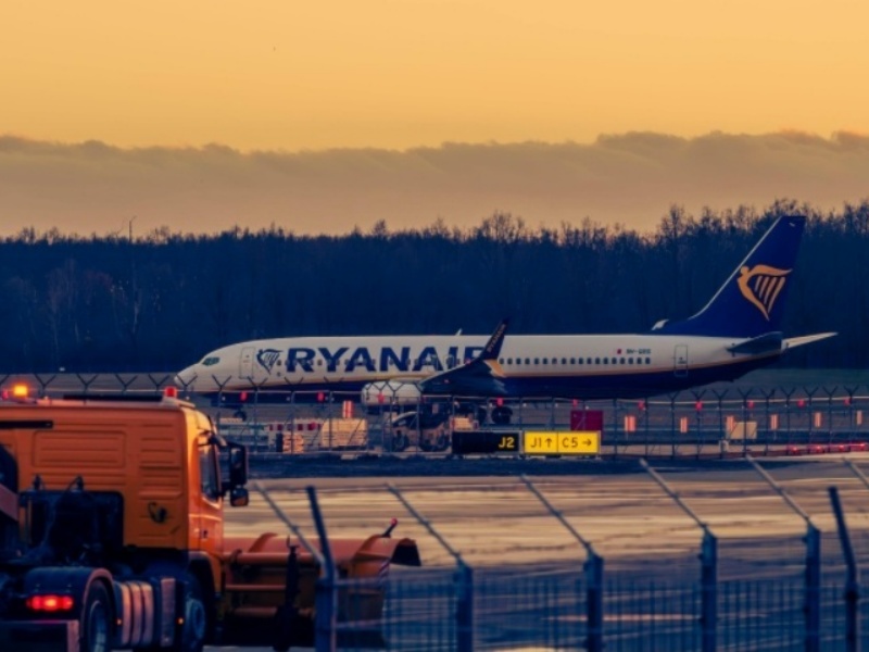
At the level of terminal control, the integrated tower system as the main carrier of an application for Smart Air Traffic Control, has deeply integrated Aviation Big Data Analysis and Air-Space Integration Monitoring data, and has been deployed in major airports such as Beijing Daxing, Nanjing Lukou, and Lanzhou Zhongchuan. The equipment, functions, and information are all fully integrated in a completely innovative way with the new system, which concentrates on the integrated processing of data related to Refined Airspace Resource Management. It has completed the integration of 18 types of core information and the interaction of heterogeneous systems, including key data modules such as UAV Operation status monitoring. Various intelligent safety warning categories have increased by 10% as compared with traditional tower operation systems, integration of information has been improved by 30% and operational efficiency of equipment maintenance has gone up by 90%, thus successfully getting rid of the technical problems in the informatization, digitization, automation and intelligence of tower control. Through multi-dimensional efficiency improvement, it provides comprehensive and accurate operational data support for controllers, significantly enhancing the decision-making efficiency and safety of tower control, and consolidating the terminal control capability of Smart Air Traffic Control.
From the perspective of the practical results that have been achieved, through the full-chain intelligent empowerment of perception, coordination, and control, the Intelligent Air Transport System is led by Smart Air Traffic Control, which depends on the computing power advantages of Aviation Big Data Analysis, the full-domain coverage capability of Air-Space Integration Monitoring, and the scientific methods of Refined Airspace Resource Management. It not only achieves a leapfrog improvement in ATC operation efficiency but also strengthens the aviation operation safety guarantee capability. Furthermore, it serves as a core technical backing to cross-border air transport coordination and standardized management of UAV Operation. Soon, with the continuous technological development, the system will further broaden the application scope of Smart Air Traffic Control, increase the degree of Refined Airspace Resource Management, upgrade Aviation Big Data Analysis algorithms, enhance the Air-Space Integration Monitoring system, and provide stronger intelligent impetus to the high-quality development of global air traffic.
FAQ – Frequently Asked Questions
1. Where and when will the Expo be held?
The event will take place days from May 13 to 15, 2026. Furthermore, the place of the event will be the Xiamen International Conference and Exhibition Center (XICEC), Xiamen, China, and the exact location is Hall C.
2. What is the size of the exhibition?
The place of the event will be about 40,000 m². The main topic of the event will be 350 companies. Besides, the event also has the ambition to draw at least 30,000 professional visitors from different parts of the world.
3. What kind of sports are there?
The organizing committee is prepared to organize more than eighty expert boards and activities. Moreover, they will discuss such topics as intelligent mobility, communication in transportation, safety, and sustainable development.
4. How many countries and regions are there?
Smart transportation could be a world summit where representatives of more than eighty different countries and regions are invited.
5. Cooperation possibilities exist, right?
We couldn't be more in agreement! The event, which consists of more than 1,000 global partners, is an excellent point where business cooperation, technological exchange, and investment exploration can happen.
6. Who can I talk to for the info?
Suppose you want to get even more facts than this. In that case, you may talk with the Organizing Committee via the "Contact Us" segment at the official website.