
Intelligent highway products for traffic safety in complex and high-density expressway scenarios basically consist of a Highway Tunnel Solution, a Dynamic Perception System that is All-round, a Smart Highway Management System, and an ETC Gantry System as their major components. These measures together form a perfect intelligence framework that covers perception, analysis, decision-making, and execution. A system integrating multi-source traffic data, artificial intelligence algorithms, and digital twin technologies provides a highway operations real-time understanding and proactive management, thus considerably increasing highway traffic safety, operational efficiency, and management capability refinement.
On the bottom tier of the data hierarchy, the system simultaneously integrates different data formats from loop detectors, video cameras, checkpoints, millimeter-wave radar, GPS positioning, and ETC Gantry System infrastructures. Together with the highway network topology and spatiotemporal traffic flow characteristics, the large data pool is exposed to filtering, structuring, and semantic association. Vehicle movements are perfectly traced through the use of interchanges, mainlines, ramps, and tunnels by a combination of unified data models and entity relationship mapping, thereby providing a solid foundation for traffic safety analysis and intelligent control.
In determining traffic condition and congestion, a Smart Highway Management System, besides forecasting traffic states, also proposes considering the unpredictability of traffic along with network bottlenecks and temporal correlations while solving expressway, urban express road, and main network node issues. Traffic states are forecasted, and abnormal transitions are detected by the use of statistical regression, clustering analysis, and hybrid neural network models. By combining real-time observations with past traffic data, the system is able to display the dynamic interaction of congestion and risk conditions, thus providing the possibility of taking preventive actions to inhibit critical threshold overstressing.
Internal to the Smart Highway Management System, intelligent video analytics and image recognition are applied in the endeavor for even more effective traffic control. The control effectiveness depends on the three main elements of supply-demand balance, spatial coordination, and temporal alignment, which are also reflected by structured indicators. These indicators help in the adoption of capacity optimization models of the network that are considered for peak and off-peak scenarios and that locate the most congested areas in the network as well as the areas where trucks will most probably be diverted.
Consequently, the multi-level coordinated control strategies are used to increase the highway throughput, reduce the occurrence of secondary accidents, and basically, improve the stability of the traffic operations.
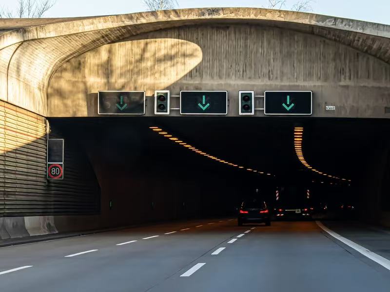
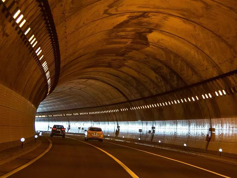
Highway Tunnel Solution utilizes digital twin technology for integrating 2D and 3D visualizations of traffic flow, environmental parameters, equipment status, and incident information. Besides being able to carry out continuous monitoring of tunnel operations, the system can also issue early risk warnings, conduct situation analysis, and visualize emergency command. Coordinated resource allocation and real-time response tracking become easier with the help of a common operating picture. Aided by this, decision-makers, equipment, and resource coordinators are made aware of the path clearance in an accident or fire event, which immensely improves the safety assurance of tunnels.
The core technology of the All-round Dynamic Perception System is millimeter-wave radar that is augmented with video sensing and ETC Gantry System data. Thus, the detection system achieves all-weather, full-coverage perception of the highway. By combining radar and camera data along with edge computing, the system can identify different road situations such as a traffic slow-down, detecting cars parked illegally, and it also gives a warning to drivers going the wrong way. The vehicle is tracked continuously by the smooth transition of the vehicle from one sensing zone to another. This not only helps traffic management but also facilitates the handling of incidents and smart tolling.
From both the operational and charging angles, the ETC Gantry System incites a huge and very precise flow of real-time traffic data to be generated. These data sets become the basis of the exact measuring of travel time, speed, and the characteristics of traffic flow which can then be of great help for network performance evaluation, congestion analysis, and toll-evasion detection. Ultimately, the tight network of the Smart Highway Management System with the ETC Gantry System will make the process of auditing, intelligent billing reconciliation, device supervision unification, and reduction of operational costs to be almost automatic, apart from increased transparency and governance efficiency.
Most of the time, the joint use of the four systems, namely Highway Tunnel Solution, All-around Dynamic Perception System, Smart Highway Management System, and ETC Gantry System, has been extensively carried out at many places. The integrated plan is a closed-loop model that ties very accurate perception, smart analysis, coordinated response, and continuous optimization together. It offers a genius, dependable, and duplicable technological approach for the digitization of highways, smarter governance, and the sustainable development of intelligent transportation in the CITSE ecosystem.
FAQ – Frequently Asked Questions
1. Where and when will the Expo be held?
The event will take place from May 13 to 15, 2026. Moreover, the location of the event is the Xiamen International Conference and Exhibition Center (XICEC), Xiamen, China, and the exact place is Hall C.
2. What is the size of the exhibition?
The location of the event will be about 40,000 m². The theme of the event will be 350 companies. Besides, the event also has the ambition to attract at least 30,000 professional visitors from all over the world.
3. What sports will be included?
The organizing committee has designed a schedule that includes over 80 technical expert panel discussions and related activities. In addition, they will discuss topics such as smart mobility, transport communications, safety and the environment, and sustainable development.
4. How many countries and regions are there?
A Smart Transportation Summit might be an event with delegates from more than 80 different countries and regions being invited.
5. Cooperation possibilities exist, right?
Totally! The event, which consists of more than 1,000 global partners, is an excellent point where business cooperation, technological exchange, and investment exploration can happen.
6. Who can I talk to for the info?
If you want to get more information than this, you can talk with the Organizing Committee through the "Contact Us" section on the official website.