The shortage of traffic police personnel is being helped by advanced monitoring equipment. To compensate for this lack and to improve surveillance at intersections and road sections, electronic monitoring means have been significantly developed. Electronic surveillance equipment is an inseparable instrument for the detection of road traffic violations and the prevention of road traffic accidents since it discourages drivers and, thus, reduces the occurrence of traffic violations. When combined with smart transport measures like electronic policing and video surveillance, it attains a high level of functional integration, among which are information collection, signal control, guidance dissemination, and command dispatch, thus, giving a thorough boost to traffic operational efficiency and service quality.
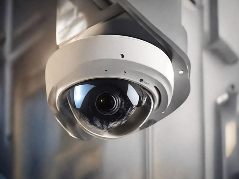
Advanced monitoring equipment is a key contributor to front-end video detection functionality. The installation of a sufficient number of fixed cameras and electronic enforcement devices along urban roads allows the holographic digital traffic control system to carry out complete, blind-spot-free monitoring of all road sections. High-definition capture cameras have a unified design and execute such functions as video image analysis, vehicle image collection for the provision of evidence, automatic number plate recognition, and compressed storage. They are capable of ascertaining the movement features of the moving targets through various detection methods, for instance, they can follow the vehicle feature information and at the same time they can analyze the vehicle movement trajectories.
Moreover, there are panoramic surveillance systems that use such technologies as augmented reality, 3D positioning, and artificial intelligence. By recording the panoramic surveillance video through AR high-point cameras and at the same time communicating with low-point cameras in the field of view, these gadgets achieve thorough three-dimensional monitoring and video linkage which is the best of both worlds - complete coverage with detailed focus. These systems exhibit low-point camera footage as picture-in-picture, thus supporting functions like querying, searching, locating, describing, alerting, and linking. This dramatically changes the surveillance systems' operational model and their practical work gets much more efficient.
Besides that, improvements in technology have resulted in the invention of the Central Monitoring Management System. It is made up of servers, system software, and operational computers and its main functions are: data and video processing, data-video fusion, remote monitoring through transmission platforms, remote parameter configuration and fire confirmation, internal system administration, and disaster response command. Operators who have gotten the necessary permissions can employ the central monitoring management system software to do real-time monitoring of all the sites or even get and review video footage from any location at any time. Administrators, according to their particular authorizations, can limit the functional capabilities of the operators to the extent that they can only perform certain functions while they (administrators) can do all of them.
The remote configuration feature is what enables the customized setting of remote monitoring units in different zones according to client specifications. It offers a map based on GIS along with video integration platform that can be linked with big-screen monitoring systems and other related systems. This expedites not only the display of safety data but also the video recordings from all over the tunnel thus making it possible for early disaster warnings and alarms and, as a result, early disaster control. The software of the Central Monitoring Management System is the hub of a community that includes the following: fire detection imaging, remote configuration, camera parameter settings, protected zones, interlocking relationships, and alarm output protocols.
FAQ – Frequently Asked Questions
1. When and where will the Expo be held?
The Expo is scheduled for the period of May 13–15, 2026, and will be held at Hall C, Xiamen International Conference and Exhibition Center (XICEC), Xiamen, China.
2. What is the exhibition scale?
The event covers an area of 40,000 m² and features 350+ companies exposers and thus, it is expected to bring together more than 30,000 professional visitors from around the world.
3. What activities are included?
There will be over 80 professional forums and events discussing topics such as intelligent mobility, communication in transportation, safety, and eco-friendly development.
4. How many countries and regions are involved?
There will be participants from 80+ countries and regions, making it a global gathering for intelligent transportation innovation.
5. Are there opportunities for cooperation?
Yes. With over 1,000 partners worldwide, the Expo is a place where lots of cooperation opportunities in business, technology, and investment are available.
6. Who can I contact for details?
If you need more information, please contact the Organizing Committee via the "Contact Us" section on the official website.